UK Cloud Inversions: How To Predict & Find A Sea Of Clouds

UK cloud inversions
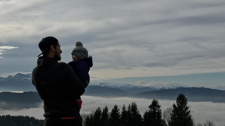
Sometimes the best mountain view begins with seeing absolutely nothing. You leave the car in grey, damp air. The valley has disappeared. Visibility may be a few hundred metres, perhaps much less.
Then, somewhere on the climb, the light begins to change. The cloud thins. Blue appears above you.
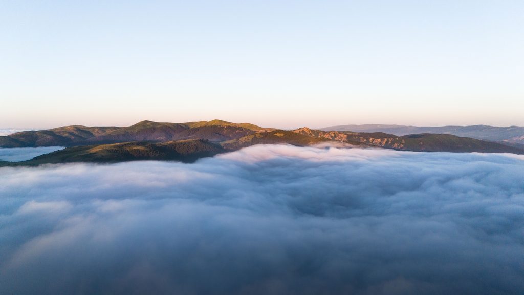
And suddenly you step out into sunshine, with a smooth white sea of cloud filling the valleys below and only the highest hills breaking through like islands.
That is the moment inversion hunters go looking for.
A cloud inversion can turn an ordinary mountain morning into something extraordinary — and although you can never guarantee one, you can learn to recognise the weather conditions that make them much more likely.
For families, that makes them particularly good adventures to chase. You are not necessarily looking for the highest summit or the hardest route. You are trying to understand the weather, make a prediction and go outside to see whether nature delivers.
What is a cloud inversion?
Normally, the air gets colder as you climb higher.
A temperature inversion reverses that pattern: a layer of warmer air sits above colder air closer to the ground. The Met Office explains that this commonly happens under high pressure, when sinking air warms and dries and can effectively trap cooler air beneath it.
A temperature inversion, by itself, does not automatically mean cloud. The trapped lower layer of air must also contain enough moisture for fog or low cloud to form. The result can be the classic sea of cloud:
- fog filling valleys and glens;
- clearer, drier air above;
- mountain summits emerging through the cloud;
- sunshine overhead while the world below remains grey.
Having the right conditions is essential for fog or sea to form. But to experience the cloud inversion effect, you also need the top of your chosen hill to actually clear the level of the cloud.
That is why finding an inversion is partly about weather forecasting – and partly about choosing the right mountain.
Why are cloud inversions so special?
Because for a few minutes the normal rules of the landscape seem to reverse. Children are used to looking up at clouds. Standing on a hill and looking down on them feels completely different. Peaks appear like islands. Cloud pours through gaps between hills. Valleys vanish.
If you catch sunrise above the cloud, the entire surface can turn gold, pink and orange while the world below remains hidden.
There is also something appealing about the uncertainty.
You may spend the first half of the climb inside cold grey fog, wondering whether the forecast was wrong. Then suddenly the cloud becomes brighter. A patch of blue appears. And you step through the top of it.
That reveal is part of what makes an inversion feel much more like a discovery than simply arriving at a viewpoint.

How do you predict a cloud inversion?
There is no single weather symbol that guarantees one. What you are looking for is a combination of clues.
1. High pressure
High pressure is one of the strongest ingredients to look for.
Under settled high pressure, air higher in the atmosphere can sink, warm and dry, producing the warmer layer that traps cooler air below. The Met Office identifies high pressure as a common setting for temperature inversions.
MWIS similarly describes high pressure, slow-moving weather patterns and an absence of fronts as classic inversion ingredients.
A large high-pressure system that has been sitting over Britain for a few days should therefore attract your attention.
2. Light winds
Strong wind mixes the layers of the atmosphere. That is generally bad news if you want cool moist air sitting neatly beneath warm dry air.
Relatively light winds are therefore useful inversion ingredients, as the allow the layers of air to remain intact.
A calm or lightly breezy forecast is usually more interesting than a windy mountain day.
3. Moisture low down
You can have a perfectly good temperature inversion with no dramatic sea of cloud at all. For that, you need moisture.
If the air trapped below the inversion reaches saturation, fog or low cloud can form. Recent rain, damp ground, lakes, rivers and moist air masses can all contribute.
The classic setup for a cloud inversion therefore needs plenty of moisture at low level, with warmer and drier air above.
4. A cold night
Long, calm nights can allow the ground to cool substantially.
The air immediately above it cools too, and cold dense air can settle into valleys and hollows. If enough moisture is present, valley fog forms.
This is one reason autumn and winter are such productive inversion seasons. Longer nights give valleys more time to cool, while the weaker winter sun may struggle to burn the fog away quickly.
Forecasters therefore expect inversions to be more common in autumn and winter for exactly these reasons.
5. Clear air above the cloud
This is the bit that produces the photograph everyone wants. Low cloud alone is not enough. You need your chosen summit to rise above the cloud into clearer air.
Specialist inversion forecasts look for a clear boundary between humid air below and drier air above, with relatively clear conditions over the inversion layer. And for all of that to be happening beneath the level of the mountain summits.
So the real question is not simply:
Will there be fog?
It is:
Where will the top of the fog be?
How high do you need to climb?
This is probably the hardest part of inversion hunting. Suppose the top of the cloud is around 500 metres. An 800-metre mountain looks promising.
But if the cloud extends to 900 metres, that same mountain simply leaves you walking through fog all morning.
The challenge is that cloud-top height is difficult to forecast precisely. Inversion altitude can vary substantially across Britain because mountains, valleys, coastlines, moisture and local airflow all affect the height of the cloud layer. Even two sides of the same mountain can behave differently.
So treat forecast cloud levels as estimates, not promises. A useful rule is to look for a healthy margin between the forecast cloud top and the summit height.
If the summit is predicted to be only 50 metres above the cloud, you may be gambling. If the cloud is expected to sit hundreds of metres below the tops, your chances look much better.

What time of day is best?
For the classic valley-fog inversion, early morning is often your best opportunity. The valley has spent the night cooling. Fog has had time to form. The atmosphere is usually at its most stable around dawn. Then the sun rises.
Sometimes the inversion remains trapped. Sometimes the ground begins warming, the fog starts breaking up and your beautiful sea of cloud disappears remarkably quickly.
That means inversion hunting occasionally involves the deeply irritating experience of reaching the viewpoint half an hour too late.
Specialist inversion forecasts therefore often focus on dawn and early-morning viewing windows.
In winter, inversions can persist much longer – sometimes all day under settled conditions – because the weaker sun struggles to warm and mix the lower atmosphere.
When are cloud inversions most likely in the UK?
They can occur at any time of year. But autumn and winter are the classic seasons.
The Met Office says inversions are most common in winter, while MWIS points to the longer nights and weaker daytime heating as reasons fog becomes easier to trap.
WeatherDuck’s archive of more than 13,000 modelled mornings also shows its strongest UK inversion signals clustering heavily in late autumn and winter, although its data represents forecast-condition signals rather than a direct count of observed inversions.
That does not mean summer inversions do not happen. They do. But the colder half of the year is when deliberately going looking for one becomes particularly worthwhile.
Where should you check for a cloud inversion forecast?
A few sources are especially useful.
Mountain Weather Information Service
MWIS is one of the best starting points. Its mountain forecasts are written specifically for hill conditions rather than simply adapting a town forecast to a summit, and its forecasters will often specifically include the potential for inversions when they’re likely. Look particularly for references to:
- inversions;
- low cloud in valleys;
- cloud levels;
- clearer air above;
- visibility;
- light winds;
- high pressure.
MWIS also publishes excellent explanations of inversion formation and the limitations of predicting cloud-top height.
Met Office mountain forecasts
The Met Office mountain forecast is another very useful tool. Unlike a normal weather-app forecast, it includes information such as:
- low-cloud levels;
- chance of cloud-free summits;
- visibility;
- summit wind;
- temperatures at elevation;
- a meteorologist’s written assessment.
The Met Office says these forecasts are issued daily and updated again in the early morning. For inversion hunting, the most interesting combination is something like:
fog or low cloud in valleys + a high chance of cloud-free summits + good visibility above.
WeatherDuck
WeatherDuck is specifically designed to identify possible UK cloud-inversion opportunities.
It looks at factors including the temperature inversion itself, low-level moisture, dry air above, wind and how long favourable conditions are expected to persist. Its current service includes a free 24-hour inversion outlook and location-based forecasts.
It can be particularly useful as an early heads-up that tomorrow morning might be worth investigating.
But treat “likely” as an invitation to look more closely – not a guarantee. WeatherDuck itself makes clear that cloud-height estimates can be wrong and that forecasts should be checked again before setting out.
Check webcams before leaving home
This is one of the simplest and most useful tricks. Many mountain areas have webcams at:
- visitor centres;
- ski centres;
- outdoor centres;
- hotels;
- nearby towns;
- mountain attractions.
If a valley camera shows grey fog while a higher-level camera shows blue sky, things are becoming interesting. Webcams can also stop you driving two hours for a forecast that has already fallen apart. Satellite imagery and recent photographs posted by walkers can provide more clues too.
Just remember that a photograph uploaded an hour ago tells you what was happening an hour ago. Cloud can change quickly.
A simple cloud-inversion checklist
You don’t need to become a meteorologist. Before committing to an early start, look for several of these clues occurring together:
- High pressure nearby
- Stable, slow-moving weather
- Light winds
- No active fronts passing through
- Moisture in the valleys
- A cold or clear night
- Fog or low cloud forecast at lower levels
- A good chance of cloud-free summits
- Good visibility above the cloud
- A summit comfortably higher than the predicted cloud top
One or two clues do not make an inversion. The more of them line up, the more interesting the forecast becomes.
Choose the hill for the inversion
Inversion hunting creates a slightly different route-choice problem. The highest mountain is not automatically the best one. What you need is:
enough height to clear the cloud + a sensible route for your family + a good viewpoint.
A familiar hill can be ideal. That matters because the lower part of the mountain may be inside dense fog. Visibility could be extremely poor. A route that feels simple in clear weather can become a genuine navigation exercise when landmarks disappear.
So don’t allow the promise of sunshine above the cloud to lure the family onto terrain you would not otherwise choose. For a first inversion hunt, we’d favour:
- a route you already know;
- a clear path;
- relatively simple navigation;
- enough height to have a realistic chance of clearing the forecast cloud;
- and somewhere with broad views once you do.
The inversion is the bonus. The underlying mountain day still needs to make sense.
Make the forecast part of the family adventure
This may be the best part of inversion hunting with children. Don’t simply tell them you’re off to see an inversion.
Show them the clues. Look at the forecast together. Find the expected cloud level. Check the summit height. Look at the wind. Discuss with them whether you’re likely to get above the clouds.
Then go and find out. As you climb, encourage them to notice what changes. Is the air still? Is it getting brighter? Can they see blue above? Does the cloud suddenly become thinner? Where does the temperature change?
The experience then becomes more than seeing something beautiful. They are learning that weather is something we can observe, understand and make informed predictions about.
And sometimes those predictions will be wrong. That is useful too. Forecasting isn’t fortune-telling. You looked at the information available, made a reasonable call and tested it against the real world.
That is good outdoor judgement.
Remember: the approach may be the difficult bit
There is an irony to inversion hunting. The summit may be warm, sunny and perfectly clear. The journey to it may involve:
- darkness;
- fog;
- frost;
- poor visibility;
- cold valley temperatures;
- wet ground.
If you are starting before sunrise, everybody needs a reliable headtorch. If you’re walking through fog, you need to be able to navigate in it. If the route contains cliffs, ridges or featureless ground, reduced visibility changes the risk significantly.
The glorious photograph from the summit tells you almost nothing about the conditions somebody experienced getting there. That is especially important with children.
Choose the route for the conditions you expect below the inversion, not the conditions you hope to find above it.
Cloud inversion FAQs
What causes a cloud inversion?
A temperature inversion occurs when warmer air sits above cooler air near the ground rather than temperature simply decreasing with height. If the trapped lower air contains enough moisture, fog or low cloud can form beneath the warmer layer.
What weather is best for cloud inversions?
High pressure, stable air, light winds, moisture at low levels and relatively dry, clear air above are particularly favourable.
What time is best for seeing a cloud inversion?
Early morning, particularly around sunrise, is often best for valley-fog inversions because overnight cooling has allowed fog to form before daytime heating begins breaking it up.
Are cloud inversions more common in winter?
Yes. Autumn and winter are particularly favourable because longer nights encourage cooling and weaker sunshine may allow fog to persist for longer. They can still occur at other times of year.
How do I know whether my summit will be above the cloud?
Compare forecast cloud-top levels with summit height, but leave a margin. Cloud-top altitude can vary locally and is one of the hardest parts of an inversion to forecast accurately.
Where can I find a UK cloud inversion forecast?
MWIS and Met Office mountain forecasts provide the underlying mountain-weather information, while specialist services such as WeatherDuck specifically highlight possible inversion conditions. Recheck close to departure because small changes in wind, moisture and cloud depth can alter the outcome.
Go looking — but leave room to be surprised
You can learn the ingredients. High pressure. Stable air. Low-level moisture. Light winds. A cold night. Cloud below a sufficiently high summit.
You can check MWIS, interrogate the Met Office mountain forecast, watch the inversion predictors and inspect every webcam you can find.
And the mountain may still refuse to cooperate. That is part of the appeal.
Because when you have climbed for an hour through cold grey fog and the world suddenly brightens around you, the first patch of blue appears overhead and you finally step into sunshine with an ocean of cloud beneath your feet, it doesn’t feel like you’ve simply found a good forecast.
It feels like you’ve discovered a secret version of the mountains.